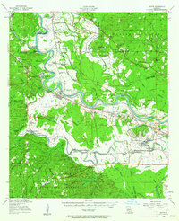
1956 Map of Boyce
USGS Topo · Published 1962About this map
The Red River meanders through the heart of this mid-century survey, defining the industrial and agricultural character of Central Louisiana. Along its banks, the Texas and Pacific railroad serves the established town of Boyce and the nearby Zimmerman mill pond, while the presence of England Air Force Base on the eastern edge signals the area's strategic importance during the Cold War era. The map reveals a densely settled rural landscape, particularly south of the river where numerous churches and cemeteries, such as Second Evening Star Ch and First Bethlehem Ch, anchor small farming communities.
Find a feature on this map
108 named features on this map. Tap any name to fly to it.
Don’t see what you’re looking for? This feature index may not catch every label — zoom into the map to look around manually.
Map Details
Editions of this 1956 Boyce Map
3 editions found

Other maps of this area

1932 · Boyce NE
USGS Topo · 1:31,680

1932 · Boyce SW
USGS Topo · 1:31,680

1932 · Colfax SW
USGS Topo · 1:31,680

1932 · Colfax SE
USGS Topo · 1:31,680

1935 · Lecompte
USGS Topo · 1:62,500

1936 · Colfax
USGS Topo · 1:62,500

1936 · Pollock
USGS Topo · 1:62,500

1937 · Chopin NE
USGS Topo · 1:31,680

1937 · Aloha
USGS Topo · 1:31,680

1937 · Montgomery
USGS Topo · 1:62,500