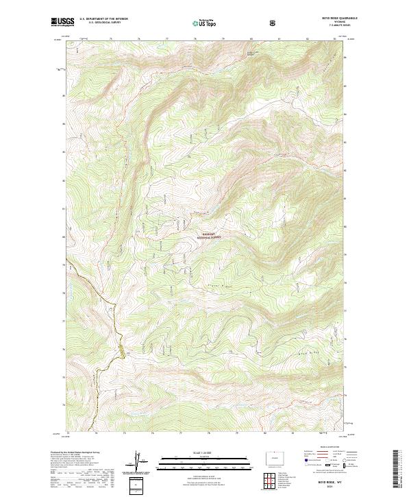
2021 Map of Boyd Ridge
USGS Topo · Published 2021About this map
Bighorn National Forest dominates this section of the high country along the border of Big Horn County and Sheridan County. The landscape is defined by a series of prominent elevated formations, including Boyd Ridge, Crater Ridge, and Horse Ridge. The network of drainage systems is complex, with numerous seasonal and perennial water sources such as Wagon Box Creek, Lodge Grass Creek, and Bucking Mule Creek carving through the terrain. Human presence is represented primarily by historical pathways and backcountry routes, notably the Lodge Grass Trail and the Pumpkin Creek Trail. These trails provide access to secluded water points like Red Spring and Crater Spring, reflecting the area's utility for livestock or mountain passage. The lack of permanent structures emphasizes the preserved wilderness character of the Lodge Grass Canyon vicinity during this era.
Find a feature on this map
25 named features on this map. Tap any name to fly to it.
Don’t see what you’re looking for? This feature index may not catch every label — zoom into the map to look around manually.
Map Details
Editions of this 2021 Boyd Ridge Map
This is the sole edition of this map. No revisions or reprints were ever made.
Other maps of this area

1894 · St. Xavier
USGS Topo · 1:125,000

1898 · Bald Mountain
USGS Topo · 1:125,000

1901 · St. Xavier
USGS Topo · 1:125,000

1901 · Bald Mountain
USGS Topo · 1:125,000

1954 · Hardin
USGS Topo · 1:250,000

1955 · Sheridan
USGS Topo · 1:250,000

1957 · Hardin
USGS Topo · 1:250,000

1958 · Hardin
USGS Topo · 1:250,000

1958 · Sheridan
USGS Topo · 1:250,000

1960 · Medicine Wheel
USGS Topo · 1:24,000