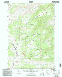
1993 Map of Boyd Ridge
USGS Topo · Published 1997About this map
Bighorn National Forest provides the backdrop for this high-altitude survey of the border between Sheridan and Big Horn Counties. The landscape is defined by the sharp elevations of Boyd Ridge and Crater Ridge, where industrial activity is marked by the presence of a Marble Quarry and its dedicated Marble Quarry Road. This area is a network of resources for seasonal livestock operations, featuring a Cow Camp, numerous stock tanks, and a designated Stock Trail winding through the drainages of Lodge Grass Creek and Wagon Box Creek. The inclusion of a lone Cem (cemetery) near Pumpkin Creek and several unnamed cabins points to the scattered, specialized settlement patterns of the high range. Infrastructure is minimal, limited to rugged paths like Sheep Mountain Road, illustrating the utilitarian nature of the territory during this era of forest management.
Find a feature on this map
26 named features on this map. Tap any name to fly to it.
Don’t see what you’re looking for? This feature index may not catch every label — zoom into the map to look around manually.
Map Details
Editions of this 1993 Boyd Ridge Map
This is the sole edition of this map. No revisions or reprints were ever made.
Other maps of this area

1894 · St. Xavier
USGS Topo · 1:125,000

1898 · Bald Mountain
USGS Topo · 1:125,000

1901 · St. Xavier
USGS Topo · 1:125,000

1901 · Bald Mountain
USGS Topo · 1:125,000

1954 · Hardin
USGS Topo · 1:250,000

1955 · Sheridan
USGS Topo · 1:250,000

1957 · Hardin
USGS Topo · 1:250,000

1958 · Hardin
USGS Topo · 1:250,000

1958 · Sheridan
USGS Topo · 1:250,000

1960 · Medicine Wheel
USGS Topo · 1:24,000