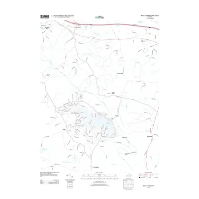
2013 Map of Boyd Tavern
USGS Topo · Published 2013About this map
Lake Monticello serves as a primary geographic anchor in this section of Fluvanna County, with its residential street network branching out from the shorelines. The Rivanna River snakes through the center of the sheet, crossed by the R Ellis Hannum Bridge near Crafton. This 2013 survey illustrates the modern transition of traditional rural landscapes into planned lakeside communities, while older settlement names like Nahor, Wildwood, and Cunningham persist along the road corridors. Evidence of historic infrastructure and transport remains visible through labels like Union Mills, Paynes Mill, and the Three Chopt Rd. Regional facilities such as State Prison Camp Number 12 and aviation sites including Snow Hill Airport and Camp Friendship Airfield highlight the diverse land use of the area, where managed forests and agricultural plots meet growing residential hubs.
Find a feature on this map
164 named features on this map. Tap any name to fly to it.
Don’t see what you’re looking for? This feature index may not catch every label — zoom into the map to look around manually.
Map Details
Editions of this 2013 Boyd Tavern Map
This is the sole edition of this map. No revisions or reprints were ever made.
Other maps of this area

1891 · Palmyra
USGS Topo · 1:125,000

1892 · Gordonsville
USGS Topo · 1:125,000

1895 · Palmyra
USGS Topo · 1:125,000

1897 · Palmyra
USGS Topo · 1:125,000

1935 · Charlottesville
USGS Topo · 1:62,500

1939 · Charlottesville
USGS Topo · 1:62,500

1943 · Scottsville
USGS Topo · 1:62,500

1946 · Scottsville
USGS Topo · 1:62,500

1947 · Roanoke
USGS Topo · 1:250,000

1949 · Charlottesville
USGS Topo · 1:250,000