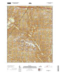
2019 Map of Boyd Tavern
USGS Topo · Published 2019About this map
Lake Monticello serves as the modern centerpiece for this area of central Virginia, where the residential coves of the lake contrast with the older milling and tavern sites of the Piedmont. The landscape is defined by the winding course of the Rivanna River, which is joined by Mechunk Creek and Boston Creek near the historic industrial hub at Union Mills. These watercourses historically powered local industry, reflected today in names like Paynes Mill and the crossing at the R Ellis Hannum Bridge.
Find a feature on this map
168 named features on this map. Tap any name to fly to it.
Don’t see what you’re looking for? This feature index may not catch every label — zoom into the map to look around manually.
Map Details
Editions of this 2019 Boyd Tavern Map
This is the sole edition of this map. No revisions or reprints were ever made.
Other maps of this area

1891 · Palmyra
USGS Topo · 1:125,000

1892 · Gordonsville
USGS Topo · 1:125,000

1895 · Palmyra
USGS Topo · 1:125,000

1897 · Palmyra
USGS Topo · 1:125,000

1935 · Charlottesville
USGS Topo · 1:62,500

1939 · Charlottesville
USGS Topo · 1:62,500

1943 · Scottsville
USGS Topo · 1:62,500

1946 · Scottsville
USGS Topo · 1:62,500

1947 · Roanoke
USGS Topo · 1:250,000

1949 · Charlottesville
USGS Topo · 1:250,000