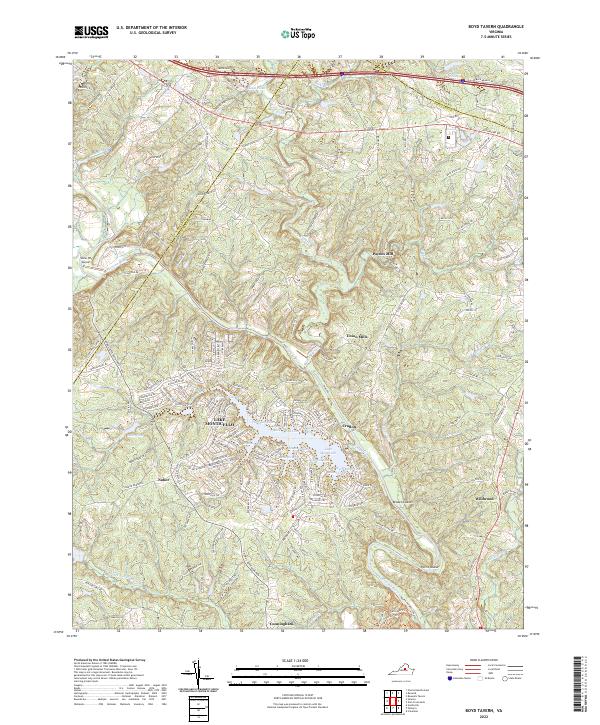
2022 Map of Boyd Tavern
USGS Topo · Published 2022About this map
Union Mills and Paynes Mill anchor the historic industrial geography along Mechunk Creek in this portion of Fluvanna County. The Rivanna River snakes through the center of the landscape, defining the topography near Pettit Island and Broken Island. Modern development is centered around the extensive shoreline of Lake Monticello, which features numerous named coves including Jefferson Cove, Washington Cove, and Madison Cove. The map also captures smaller rural hubs like Cunningham and Nahor, alongside the Snow Hill Airport near the Albemarle county line. To the north, the corridor following Richmond Rd and the proximity to Brickhead Pond show the transition from agricultural land to more concentrated residential and transport networks.
Find a feature on this map
177 named features on this map. Tap any name to fly to it.
Don’t see what you’re looking for? This feature index may not catch every label — zoom into the map to look around manually.
Map Details
Editions of this 2022 Boyd Tavern Map
This is the sole edition of this map. No revisions or reprints were ever made.
Other maps of this area

1891 · Palmyra
USGS Topo · 1:125,000

1892 · Gordonsville
USGS Topo · 1:125,000

1895 · Palmyra
USGS Topo · 1:125,000

1897 · Palmyra
USGS Topo · 1:125,000

1935 · Charlottesville
USGS Topo · 1:62,500

1939 · Charlottesville
USGS Topo · 1:62,500

1943 · Scottsville
USGS Topo · 1:62,500

1946 · Scottsville
USGS Topo · 1:62,500

1947 · Roanoke
USGS Topo · 1:250,000

1949 · Charlottesville
USGS Topo · 1:250,000