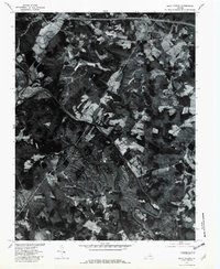
1979 Map of Boyd Tavern
USGS Topo · Published 1982About this map
Lake Monticello dominates the central landscape of this 1979 orthophotoquad, showcasing the intensive residential development surrounding its complex, branching shoreline. The imagery, captured by the U.S. Geological Survey in cooperation with the Soil Conservation Service, reveals a stark contrast between the planned density of the lakeside community and the surrounding rural topography. The Rivanna River snakes across the terrain, joined by Mechunk Creek in a region historically characterized by dispersed settlements such as Boyd Tavern and Nahor. South of the primary lake, the Fluvanna Ruritan Lake appears within a more traditional woodland setting. This survey provides a precise visual record of the Fluvanna County landscape during a period of significant residential expansion, highlighting how the artificial lake reshaped local settlement patterns and land use.
Find a feature on this map
9 named features on this map. Tap any name to fly to it.
Don’t see what you’re looking for? This feature index may not catch every label — zoom into the map to look around manually.
Map Details
Editions of this 1979 Boyd Tavern Map
This is the sole edition of this map. No revisions or reprints were ever made.
Other maps of this area

1891 · Palmyra
USGS Topo · 1:125,000

1892 · Gordonsville
USGS Topo · 1:125,000

1895 · Palmyra
USGS Topo · 1:125,000

1897 · Palmyra
USGS Topo · 1:125,000

1935 · Charlottesville
USGS Topo · 1:62,500

1939 · Charlottesville
USGS Topo · 1:62,500

1943 · Scottsville
USGS Topo · 1:62,500

1946 · Scottsville
USGS Topo · 1:62,500

1947 · Roanoke
USGS Topo · 1:250,000

1949 · Charlottesville
USGS Topo · 1:250,000