
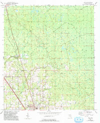
1954 Map of Boyd
USGS Topo · Published 1955About this map
Perry anchors the southern edge of this mid-century Florida landscape, serving as a hub for both rail and emerging local communications. The northern portion of town features the Radio Station (WPRY), while a dedicated Landing Field sits just south of the community of Boyd. This era shows a transition between traditional rural life and modern infrastructure, where the Southern and Atlantic Coast Line railroads intersect the timber-rich surroundings of Southern Pine Bay. Scattered across the piney woods and creek bottoms are essential community landmarks for genealogists, including Shiloh Ch and its accompanying Shiloh Cem, alongside Mt Carmel Ch and Friendship Ch. The terrain is defined by slow-moving water systems like Woods Creek and Spring Creek, which navigate the low-lying Florida panhandle geography.
Find a feature on this map
17 named features on this map. Tap any name to fly to it.
Don’t see what you’re looking for? This feature index may not catch every label — zoom into the map to look around manually.
Map Details
Editions of this 1954 Boyd Map
2 editions found
Other maps of this area

1952 · Secotan
USGS Topo · 1:24,000

1954 · Fenholloway
USGS Topo · 1:24,000

1954 · Hampton Springs
USGS Topo · 1:24,000

1954 · Secotan
USGS Topo · 1:24,000

1954 · Day NW
USGS Topo · 1:24,000

1954 · Valdosta
USGS Topo · 1:250,000

1955 · Perry
USGS Topo · 1:24,000

1955 · Shady Grove
USGS Topo · 1:24,000

1955 · Greenville SE
USGS Topo · 1:24,000
1956 · Hampton Springs
USGS Topo · 1:25,000