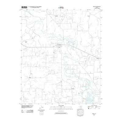
2010 Map of Boyd
USGS Topo · Published 2010About this map
Boyd serves as the central hub in this north Texas landscape, where the West Fork Trinity River winds through a complex network of tributaries including Walnut Creek, Walker Creek, and Deep Creek. The geography reveals a blend of rural settlement and industrial activity, notably at the Cottondale East Gas Field in the west. A heavy concentration of small family and community burial grounds, such as Arkansas Cemetery, Stokes Cemetery, and Pope Cemetery, provides a wealth of data for local historians and genealogists. Further south, the map captures the upper reaches of Eagle Mountain Lake, where Oates Branch and Hog Branch feed into the larger reservoir system. The road network, including FM 730 and FM 718, connects dispersed communities like Annaville, Aurora, and Fairview across the varied terrain of the Trinity River basin.
Find a feature on this map
76 named features on this map. Tap any name to fly to it.
Don’t see what you’re looking for? This feature index may not catch every label — zoom into the map to look around manually.
Map Details
Editions of this 2010 Boyd Map
This is the sole edition of this map. No revisions or reprints were ever made.
Other maps of this area

1891 · Weatherford
USGS Topo · 1:125,000

1893 · Weatherford
USGS Topo · 1:125,000

1894 · Fort Worth
USGS Topo · 1:125,000

1924 · Sunset 4-d
USGS Topo · 1:48,000

1930 · Boyd
USGS Topo · 1:62,500

1932 · Springtown
USGS Topo · 1:62,500

1954 · Dallas
USGS Topo · 1:250,000

1954 · Sherman
USGS Topo · 1:250,000

1955 · Avondale
USGS Topo · 1:24,000

1955 · Azle
USGS Topo · 1:24,000