2022 Map of Boyd
USGS Topo · Published 2022About this map
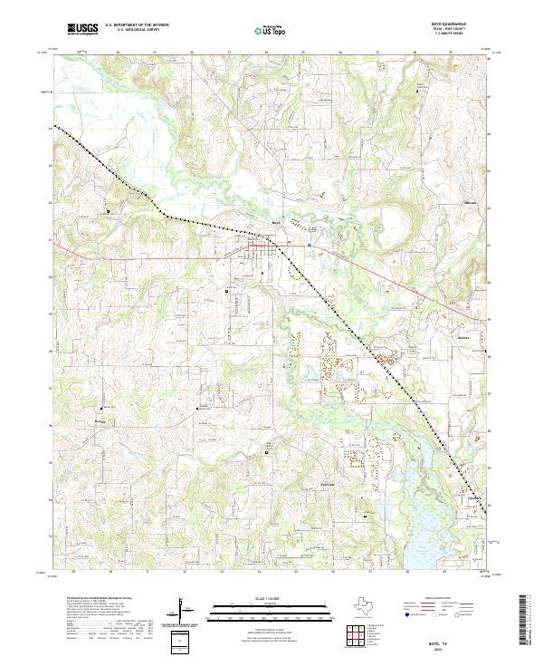
The West Fork Trinity River winds through this Wise County landscape, defining the character of the terrain north of the northern reaches of Eagle Mountain Lake. The central hub of Boyd is depicted with a detailed street grid, including its connection to the rail corridor along W Rock Island Ave. This area is particularly significant for genealogical research, as it preserves the locations of numerous small family and community burial grounds such as Arkansas Cem, Hog Branch Cem, and Pleasant Grove Cem. The map illustrates the transition from the consolidated town centers of Rhome and Aurora to the scattered settlements of Keeter and Fairview. The complex drainage network of Walnut Cr, Deep Cr, and Blue Cr highlights the water-rich bottomlands that shaped the local agricultural and settlement patterns before the full development of suburban expansion.
Find a feature on this map
147 named features on this map. Tap any name to fly to it.
Don’t see what you’re looking for? This feature index may not catch every label — zoom into the map to look around manually.
Map Details
Editions of this 2022 Boyd Map
This is the sole edition of this map. No revisions or reprints were ever made.