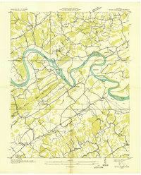
1935 Map of Boyds Creek
USGS Topo · Published 1935About this map
The French Broad River snakes through the heart of this East Tennessee landscape, defining the rural character of the border between Knox and Sevier counties. In the mid-1930s, the river remained a primary geographical focus, featuring prominent crossings like Huffaker Ferry and numerous named bends such as Underwood Bend and Seclusion Bend. The map documents a dense network of country schools and churches that served these farming communities, including Highland View Sch, Boyds Creek Ch, and East Stony Point Sch.
Find a feature on this map
75 named features on this map. Tap any name to fly to it.
Don’t see what you’re looking for? This feature index may not catch every label — zoom into the map to look around manually.
Map Details
Editions of this 1935 Boyds Creek Map
2 editions found
Other maps of this area

1886 · Knoxville
USGS Topo · 1:125,000

1892 · Knoxville
USGS Topo · 1:125,000

1894 · Knoxville
USGS Topo · 1:125,000

1895 · Knoxville
USGS Topo · 1:125,000

1897 · Maynardville
USGS Topo · 1:125,000

1900 · Maynardville
USGS Topo · 1:125,000

1901 · Knoxville
USGS Topo · 1:125,000

1935 · Mascot
USGS Topo · 1:24,000

1935 · Knoxville
USGS Topo · 1:48,000

1935 · Straw Plains
USGS Topo · 1:48,000