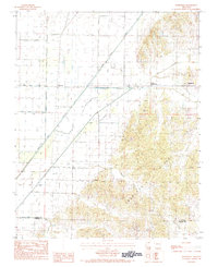
1984 Map of Boydsville
USGS Topo · Published 1984About this map
Crowleys Ridge dominates the eastern half of this landscape, creating a distinct upland contrast to the reclaimed wetlands of the Mississippi Alluvial Plain to the west. This topographic study captures the area during the early 1980s, illustrating an agricultural economy shaped by extensive water management. The Cache River Ditch and North Ditch run straight through the lowlands, a network of engineering designed to drain the fertile soil for cultivation.
Find a feature on this map
11 named features on this map. Tap any name to fly to it.
Don’t see what you’re looking for? This feature index may not catch every label — zoom into the map to look around manually.
Map Details
Editions of this 1984 Boydsville Map
2 editions found
Other maps of this area

1935 · Rector
USGS Topo · 1:62,500

1935 · Knobel
USGS Topo · 1:62,500

1940 · Gainesville
USGS Topo · 1:62,500

1940 · Marmaduke
USGS Topo · 1:62,500

1941 · Knobel
USGS Topo · 1:62,500

1957 · Poplar Bluff
USGS Topo · 1:250,000

1958 · Marmaduke
USGS Topo · 1:62,500

1958 · Gainesville
USGS Topo · 1:62,500

1958 · Rector
USGS Topo · 1:62,500

1959 · Poplar Bluff
USGS Topo · 1:250,000