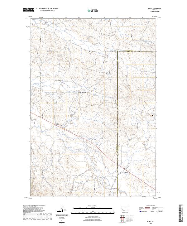
2024 Map of Boyes
USGS Topo · Published 2024About this map
The settlement of Boyes sits at the intersection of local routes near the southeastern edge of this landscape, serving as a focal point for the surrounding ranchlands. The terrain is defined by prominent elevations such as Deranleau Butte and Morellas Butte, which overlook a network of seasonal watercourses including Burdette Creek and Hay Creek. This contemporary survey illustrates the persistent rural character of the region, where the county line between Powder River and Carter counties divides the open range north of the East Fork Little Powder River.
Find a feature on this map
25 named features on this map. Tap any name to fly to it.
Don’t see what you’re looking for? This feature index may not catch every label — zoom into the map to look around manually.
Map Details
Editions of this 2024 Boyes Map
This is the sole edition of this map. No revisions or reprints were ever made.
Other maps of this area

1954 · Ekalaka
USGS Topo · 1:250,000

1956 · Ekalaka
USGS Topo · 1:250,000

1958 · Ekalaka
USGS Topo · 1:250,000

1965 · Ekalaka
USGS Topo · 1:250,000

1970 · Sanburn Reservoir
USGS Topo · 1:24,000
1970 · Belle Creek North
USGS Topo · 1:24,000
1970 · Hammond
USGS Topo · 1:24,000

1980 · Broadus
USGS Topo · 1:100,000

1981 · Alzada
USGS Topo · 1:100,000
1982 · Knudson Draw
USGS Topo · 1:24,000