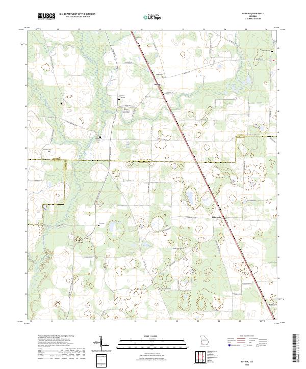
2024 Map of Boykin
USGS Topo · Published 2024About this map
Spring Creek winds through this landscape on the border of Miller, Decatur, and Seminole Counties, anchoring a rural agricultural region defined by small settlements and historic burial grounds. The community of Boykin serves as a central point, situated near the headwaters of Big Drain and surrounded by a network of family-named roads such as Meredith Rd and Mcnease Rd. Genealogists will find significant value in the numerous recorded cemeteries, including the Mothers Home Baptist Church Cem and the Scarborough Cem, which speak to the long-standing family lineages of this Georgia corner.
Find a feature on this map
69 named features on this map. Tap any name to fly to it.
Don’t see what you’re looking for? This feature index may not catch every label — zoom into the map to look around manually.
Map Details
Editions of this 2024 Boykin Map
This is the sole edition of this map. No revisions or reprints were ever made.
Other maps of this area

1953 · Dothan
USGS Topo · 1:250,000

1954 · Dothan
USGS Topo · 1:250,000

1954 · Desser
USGS Topo · 1:24,000

1954 · Tallahassee
USGS Topo · 1:250,000

1955 · Dothan
USGS Topo · 1:250,000

1955 · Bainbridge
USGS Topo · 1:62,500

1959 · Tallahassee
USGS Topo · 1:250,000

1960 · Tallahassee
USGS Topo · 1:250,000

1974 · Boykin
USGS Topo · 1:24,000

1974 · Donalsonville NE
USGS Topo · 1:24,000