
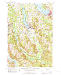
1961 Map of Boyne City
USGS Topo · Published 1963About this map
South Arm Lake Charlevoix dominates this northern Michigan landscape, where the Jordan River flows into the southern tip of the lake at East Jordan. The 1961 field check captures a network of small agricultural and lakeside settlements connected by the Chesapeake and Ohio railroad, which skirts the western edge of the quadrangle through Ellsworth and Central Lake. Higher ground is marked by prominent landforms such as Avalanche Mountain near Boyne City and Richardson Hill to the west.
Find a feature on this map
95 named features on this map. Tap any name to fly to it.
Don’t see what you’re looking for? This feature index may not catch every label — zoom into the map to look around manually.
Map Details
Editions of this 1961 Boyne City Map
2 editions found
Other maps of this area

1954 · Central Lake
USGS Topo · 1:62,500

1954 · Charlevoix
USGS Topo · 1:62,500

1954 · Traverse City
USGS Topo · 1:250,000

1955 · Cheboygan
USGS Topo · 1:250,000

1956 · Alba
USGS Topo · 1:62,500

1956 · Mancelona
USGS Topo · 1:62,500

1957 · Elk Rapids
USGS Topo · 1:62,500

1958 · Cheboygan
USGS Topo · 1:250,000

1958 · Traverse City
USGS Topo · 1:250,000

1958 · Bayshore
USGS Topo · 1:62,500