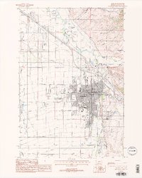
1987 Map of Bozeman
USGS Topo · Published 1988About this map
Bozeman serves as the focal point of this Gallatin County survey, showing the city's 1980s layout as it balances urban expansion with an intricate system of agricultural irrigation. The expansive campus of Montana State University occupies a significant portion of the city's southern section, while the Northern Pacific railroad tracks bisect the northern neighborhoods. The landscape is defined by its water management, featuring a dense network of man-made waterways like the West Gallatin Canal, Farmers Canal, and the Beck Border Ditch, which redirect flow from natural sources such as Hyalite Creek and Sourdough Creek. On the eastern edge, the terrain begins to rise toward Bozeman Pass, with civic landmarks like Sunset Hills Cemetery and Lindley Park overlooking the valley. Traces of older transport routes are visible in the Old Railroad Grade winding through the northern hills near Sypes Creek.
Find a feature on this map
46 named features on this map. Tap any name to fly to it.
Don’t see what you’re looking for? This feature index may not catch every label — zoom into the map to look around manually.
Map Details
Editions of this 1987 Bozeman Map
2 editions found
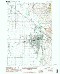
Other maps of this area

1888 · Three Forks
USGS Topo · 1:250,000

1891 · Livingston
USGS Topo · 1:250,000

1893 · Livingston
USGS Topo · 1:250,000

1894 · Three Forks
USGS Topo · 1:250,000

1895 · Three Forks
USGS Topo · 1:250,000

1947 · Bozeman
USGS Topo · 1:250,000

1948 · Bozeman
USGS Topo · 1:250,000

1950 · Belgrade
USGS Topo · 1:62,500

1951 · Bozeman Pass
USGS Topo · 1:62,500

1951 · Sedan
USGS Topo · 1:62,500