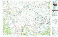
1992 Map of Bozeman
USGS Topo · Published 1992About this map
The Missouri River Headwaters serves as the geographic anchor of this 1992 study, where the Jefferson, Madison, and Gallatin rivers converge to form the Missouri. This region is a complex intersection of mountain ranges and valley floors, including the Gallatin Valley and the towering Bridger Range to the northeast. To the west, the Tobacco Root Mountains contain a legacy of resource extraction, evidenced by labels like the Garnet Gold Mine and Strawberry Mine.
Find a feature on this map
150 named features on this map. Tap any name to fly to it.
Don’t see what you’re looking for? This feature index may not catch every label — zoom into the map to look around manually.
Map Details
Editions of this 1992 Bozeman Map
This is the sole edition of this map. No revisions or reprints were ever made.
Other maps of this area

1886 · Fort Logan
USGS Topo · 1:250,000

1886 · Little Belt Mts.
USGS Topo · 1:250,000

1888 · Three Forks
USGS Topo · 1:250,000

1889 · Helena
USGS Topo · 1:250,000

1891 · Livingston
USGS Topo · 1:250,000

1893 · Helena
USGS Topo · 1:250,000

1893 · Dillon
USGS Topo · 1:250,000

1893 · Livingston
USGS Topo · 1:250,000

1894 · Three Forks
USGS Topo · 1:250,000

1894 · Little Belt Mts.
USGS Topo · 1:250,000