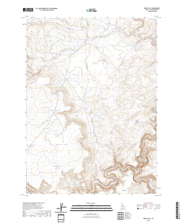
2023 Map of Brace Flat
USGS Topo · Published 2023About this map
The Owyhee River Wilderness dominates the southern landscape of this Idaho quadrangle, defined by the deep incisions of the Owyhee Wild and Scenic River as it winds through Owyhee Canyon. This high desert environment is characterized by extensive plateaus and tables, most notably Lambert Table and the eponymous Brace Flat. The water management of the region is evident through a series of named catchments like North Lambert Reservoir, Brace Reservoir, and Warm Springs Reservoir, which serve as vital points in an otherwise arid expanse.
Find a feature on this map
36 named features on this map. Tap any name to fly to it.
Don’t see what you’re looking for? This feature index may not catch every label — zoom into the map to look around manually.
Map Details
Editions of this 2023 Brace Flat Map
This is the sole edition of this map. No revisions or reprints were ever made.
Other maps of this area

1955 · Jordan Valley
USGS Topo · 1:250,000

1957 · Jordan Valley
USGS Topo · 1:250,000

1958 · Jordan Valley
USGS Topo · 1:250,000

1973 · Red Basin
USGS Topo · 1:24,000
1973 · Piute Basin West
USGS Topo · 1:24,000

1973 · Smith Creek
USGS Topo · 1:24,000

1973 · Castro Table
USGS Topo · 1:24,000

1973 · Grassy Ridge
USGS Topo · 1:24,000
1973 · Dickshooter Reservoir
USGS Topo · 1:24,000

1973 · Brace Flat
USGS Topo · 1:24,000