2012 Map of Brad
USGS Topo · Published 2012About this map
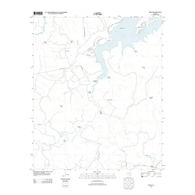
Possum Kingdom State Park and the sprawling southern reaches of Possum Kingdom Lake dominate the northern landscape of this North Texas survey. The rugged topography is defined by a dense network of named draws and ridges, including Texawa Canyon, Yellow Gap, and the family-named Sam Bass Hollow. Resource extraction is evident at the Iles Oil Field near Hughes Mtn, illustrating the region's mid-century industrial footprint. To the south, the settlement of Brad serves as a junction point along Brad Rd, situated near the confluence of Brad Br and Little Ioni Cr. The map details a transition from recreational shoreline at Caddo Bay and Bass Island to the interior cattle and ranching lands accessible via routes like Set Ranch Rd and S & S Ranch Rd.
Find a feature on this map
47 named features on this map. Tap any name to fly to it.
Don’t see what you’re looking for? This feature index may not catch every label — zoom into the map to look around manually.
Map Details
Editions of this 2012 Brad Map
This is the sole edition of this map. No revisions or reprints were ever made.
Other maps of this area

1890 · Breckenridge
USGS Topo · 1:125,000

1891 · Palo Pinto
USGS Topo · 1:125,000

1918 · Palo Pinto
USGS Topo · 1:125,000

1924 · Breckenridge 1-a
USGS Topo · 1:48,000

1924 · Palo Pinto 2-b
USGS Topo · 1:48,000

1924 · Palo Pinto 2-c
USGS Topo · 1:48,000

1924 · Breckenridge 1-d
USGS Topo · 1:48,000

1925 · Breckenridge 1-b
USGS Topo · 1:48,000

1927 · Pickwick
USGS Topo · 1:62,500

1931 · Ivan
USGS Topo · 1:62,500