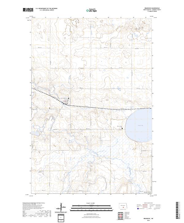
2024 Map of Braddock
USGS Topo · Published 2024About this map
Braddock anchors this landscape in Emmons County, where the settlement’s layout follows the trajectory of Railroad Ave E and Logan St. The surrounding terrain is defined by the Altamont Moraine, a glacial feature that influences the drainage of Goose Creek and Long Lake Creek as they wind through the prairie. This survey captures a mix of agricultural utility and conservation, most notably at the Emmons County Waterfowl Production Area surrounding Goose Lake. For those tracing local heritage, the map identifies several distinct burial sites including Saint Katherines Cem, the Braddock Cem, and the Maria Lutheran Cem further east. The grid of section lines and range roads, such as 16th Ave SE and 58th St SE, illustrates the persistent township and range organization of this North Dakota heartland.
Find a feature on this map
31 named features on this map. Tap any name to fly to it.
Don’t see what you’re looking for? This feature index may not catch every label — zoom into the map to look around manually.
Map Details
Editions of this 2024 Braddock Map
This is the sole edition of this map. No revisions or reprints were ever made.
Other maps of this area

1953 · Jamestown
USGS Topo · 1:250,000

1954 · Bismarck
USGS Topo · 1:250,000

1956 · Jamestown
USGS Topo · 1:250,000

1958 · Bismarck
USGS Topo · 1:250,000

1975 · Dana
USGS Topo · 1:24,000

1975 · Appert Lake
USGS Topo · 1:24,000

1975 · Linton NE
USGS Topo · 1:24,000
1975 · Braddock NW
USGS Topo · 1:24,000

1975 · Braddock
USGS Topo · 1:24,000
1975 · Braddock NE
USGS Topo · 1:24,000