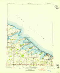
1952 Map of Braddock Heights
USGS Topo · Published 1954About this map
Lake Ontario dominates the northern horizon of this Monroe County coastal landscape, where a series of prominent lagoons and marshes define the shoreline geography. The 1952 revision of this area, originally surveyed in 1931, captures the post-war residential expansion along the lakefront, notably at Braddock Heights and Grand View Heights. These seasonal and year-round communities are built upon narrow barrier spits like Crescent Beach and Grand View Beach, which separate the open lake from inland waters such as Cranberry Pond, Long Pond, and Buck Pond. Further inland, the character of the town of Greece transitions into a more rural grid of agricultural tracts and small crossroads settlements. Local landmarks like Greece Sta, North Greece, and School No 2 provide essential reference points for genealogists tracing family land holdings near the winding courses of Northrup Creek and Larkin Creek.
Find a feature on this map
59 named features on this map. Tap any name to fly to it.
Don’t see what you’re looking for? This feature index may not catch every label — zoom into the map to look around manually.
Map Details
Editions of this 1952 Braddock Heights Map
4 editions found
Other maps of this area

1895 · Rochester
USGS Topo · 1:62,500

1895 · Ontario Beach
USGS Topo · 1:62,500

1898 · Rochester
USGS Topo · 1:62,500

1899 · Hamlin
USGS Topo · 1:62,500

1899 · Ontario Beach
USGS Topo · 1:62,500

1899 · Brockport
USGS Topo · 1:62,500

1912 · Rochester
USGS Topo · 1:62,500

1912 · Ontario Beach
USGS Topo · 1:62,500

1920 · Rochester
USGS Topo · 1:62,500

1931 · Rochester West
USGS Topo · 1:24,000