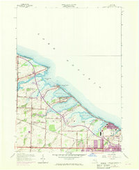
1952 Map of Braddock Heights
USGS Topo · Published 1970About this map
Lake Ontario dominates the northern horizon of this coastal survey, where a series of large ponds and marshes define the shoreline of Greece. The landscape is a complex of sandbars and spits, home to communities like Braddock Heights and Grand View Heights that sit between the open lake and protected waters such as Cranberry Pond, Long Pond, and Buck Pond. Purple revision overlays from 1969 show the rapid suburban expansion extending toward Mount Read and the Lake Ontario State Parkway.
Find a feature on this map
60 named features on this map. Tap any name to fly to it.
Don’t see what you’re looking for? This feature index may not catch every label — zoom into the map to look around manually.
Map Details
Editions of this 1952 Braddock Heights Map
4 editions found
Other maps of this area

1895 · Rochester
USGS Topo · 1:62,500

1895 · Ontario Beach
USGS Topo · 1:62,500

1898 · Rochester
USGS Topo · 1:62,500

1899 · Hamlin
USGS Topo · 1:62,500

1899 · Ontario Beach
USGS Topo · 1:62,500

1899 · Brockport
USGS Topo · 1:62,500

1912 · Rochester
USGS Topo · 1:62,500

1912 · Ontario Beach
USGS Topo · 1:62,500

1920 · Rochester
USGS Topo · 1:62,500

1931 · Rochester West
USGS Topo · 1:24,000