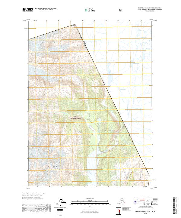
2021 Map of Bradfield Canal A-1 SE
USGS Topo · Published 2021About this map
The United States of America Canada border bisects this remote section of the Tongass National Forest, following the high peaks of the Coast Mountains. This survey documents a landscape dominated by the drainage systems of the Salmon River and Texas Creek, which carve deep valleys through the Lincoln Mountains and Reverdy Mountains. The presence of State Highway 12 - Salmon River and the Titan Trl provide the only established routes through this wilderness. Notable landmarks like Mineral Hill and Ninemile Mtn rise above the river basins, while a network of glacial-fed waters including Tunnel Lake, Hog Lake, and Noname Lake are clustered in the northeastern quadrant. The map detail reflects the region's complex hydrology, from the Cascade River to numerous named tributaries like Daly Cr and Fish Cr.
Find a feature on this map
36 named features on this map. Tap any name to fly to it.
Don’t see what you’re looking for? This feature index may not catch every label — zoom into the map to look around manually.
Map Details
Editions of this 2021 Bradfield Canal A-1 SE Map
This is the sole edition of this map. No revisions or reprints were ever made.
Other maps of this area

1951 · Bradfield Canal
USGS Topo · 1:250,000

1952 · Ketchikan
USGS Topo · 1:250,000

1954 · Bradfield Canal
USGS Topo · 1:250,000

1955 · Bradfield Canal A-1
USGS Topo · 1:63,360

1955 · Ketchikan D-1
USGS Topo · 1:63,360

1955 · Ketchikan
USGS Topo · 1:250,000

1955 · Bradfield Canal
USGS Topo · 1:250,000
1996 · Bradfield Canal A-1
USGS Topo · 1:63,360
1997 · Bradfield Canal A-1
USGS Topo · 1:63,360
2000 · Bradfield Canal A-1
USGS Topo · 1:63,360