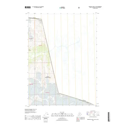
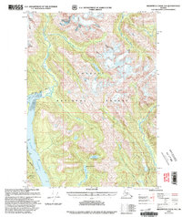
2018 Map of Bradfield Canal A-2 NE
USGS Topo · Published 2018About this map
The Canada United States Of America international boundary bisects this high-elevation landscape within the Coast Mountains. This 2018 survey reveals a terrain defined by steep verticality and glaciated peaks, where the southeastern edge of the Tongass National Forest meets the Canadian border. The map is anchored by significant summits including Mt Willibert, Mt John Jay, and Mt Upshur, which trace the jagged line between Alaska and British Columbia. This section of the boundary area, though lacking human settlements or roads, provides a precise record of the topography and natural hydrology that dictates the border's path through some of the most challenging terrain in North America. Researchers can trace the complex drainage patterns and ridgelines that separate the two nations in this remote corridor.
Find a feature on this map
10 named features on this map. Tap any name to fly to it.
Don’t see what you’re looking for? This feature index may not catch every label — zoom into the map to look around manually.
Map Details
Editions of this 2018 Bradfield Canal A-2 NE Map
This is the sole edition of this map. No revisions or reprints were ever made.
Other maps of this area

1951 · Bradfield Canal
USGS Topo · 1:250,000

1954 · Bradfield Canal
USGS Topo · 1:250,000

1955 · Bradfield canal B-2
USGS Topo · 1:63,360

1955 · Bradfield canal A-2
USGS Topo · 1:63,360

1955 · Bradfield Canal A-1
USGS Topo · 1:63,360

1955 · Bradfield Canal
USGS Topo · 1:250,000
1973 · Bradfield Canal B-2
USGS Topo · 1:63,360
1996 · Bradfield Canal A-1
USGS Topo · 1:63,360
1997 · Bradfield Canal A-1
USGS Topo · 1:63,360
2000 · Bradfield Canal A-1
USGS Topo · 1:63,360