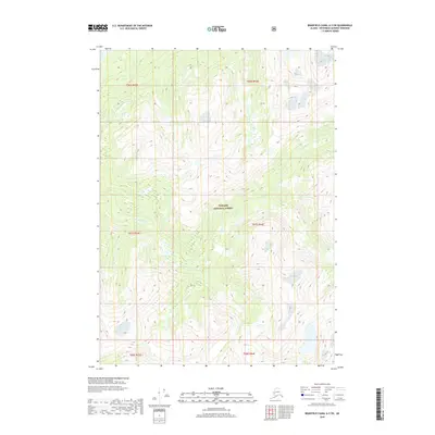
2018 Map of Bradfield Canal A-3 SW
USGS Topo · Published 2018About this map
Klahini River winds through this section of the Tongass National Forest in southeast Alaska, carving a path through the steep terrain of the Ketchikan Gateway Borough. The river's course serves as the primary hydrological feature of this wilderness area, flanked by several smaller tributary drainage systems. This 2018 survey illustrates the complex topography of the region, defining the public land boundaries within the Tongass National Forest and the various township and range designations, including t67s r93e and t67s r94e. The map reflects a landscape defined by its hydrography and elevation, where the remote river valley provides the only named geographic landmark amidst the high-altitude wetlands and slopes.
Find a feature on this map
8 named features on this map. Tap any name to fly to it.
Don’t see what you’re looking for? This feature index may not catch every label — zoom into the map to look around manually.
Map Details
Editions of this 2018 Bradfield Canal A-3 SW Map
This is the sole edition of this map. No revisions or reprints were ever made.
Other maps of this area

1951 · Bradfield Canal
USGS Topo · 1:250,000

1952 · Ketchikan
USGS Topo · 1:250,000

1954 · Bradfield Canal
USGS Topo · 1:250,000

1955 · Bradfield canal A-4
USGS Topo · 1:63,360

1955 · Ketchikan D-4
USGS Topo · 1:63,360

1955 · Ketchikan D-3
USGS Topo · 1:63,360

1955 · Bradfield canal A-3
USGS Topo · 1:63,360

1955 · Ketchikan
USGS Topo · 1:250,000

1955 · Bradfield Canal
USGS Topo · 1:250,000
1962 · Ketchikan D-4
USGS Topo · 1:63,360