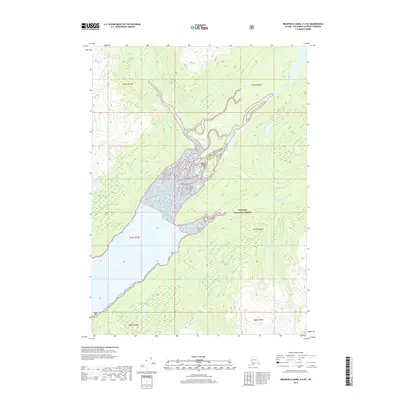
2017 Map of Bradfield Canal A-4 SE
USGS Topo · Published 2017About this map
Tongass National Forest dominates this coastal Alaskan landscape, where the braided channels of the Unuk River meet the tidewaters of Burroughs Bay. The terrain is defined by dramatic elevation changes and a complex hydrological network, most notably the silt-laden delta area surrounding the Willow Islands. The convergence of the Klahini River and the larger Unuk system creates a vast intertidal zone and alluvial plain that illustrates the dynamic nature of the Southeast Alaska panhandle. Surveyed in 2017, this map details the Public Land Survey System divisions, including t66s r93e and t67s r92e, providing a precise record of federal land management boundaries within the Ketchikan Gateway Borough.
Find a feature on this map
9 named features on this map. Tap any name to fly to it.
Don’t see what you’re looking for? This feature index may not catch every label — zoom into the map to look around manually.
Map Details
Editions of this 2017 Bradfield Canal A-4 SE Map
This is the sole edition of this map. No revisions or reprints were ever made.
Other maps of this area

1951 · Bradfield Canal
USGS Topo · 1:250,000

1952 · Ketchikan
USGS Topo · 1:250,000

1954 · Bradfield Canal
USGS Topo · 1:250,000

1955 · Bradfield canal A-4
USGS Topo · 1:63,360

1955 · Ketchikan D-4
USGS Topo · 1:63,360

1955 · Ketchikan D-3
USGS Topo · 1:63,360

1955 · Bradfield canal A-3
USGS Topo · 1:63,360

1955 · Ketchikan
USGS Topo · 1:250,000

1955 · Bradfield Canal
USGS Topo · 1:250,000
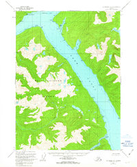
1962 · Ketchikan D-4
USGS Topo · 1:63,360