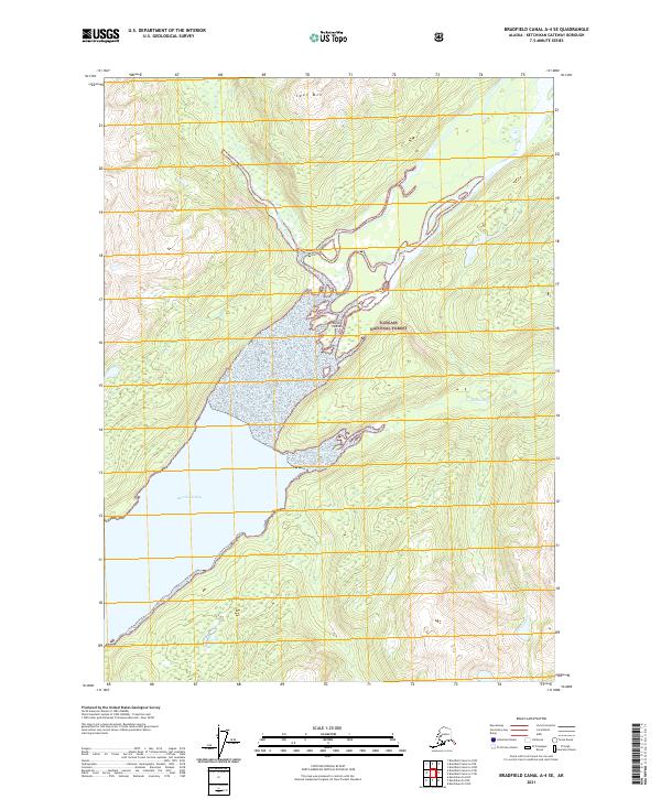
2021 Map of Bradfield Canal A-4 SE
USGS Topo · Published 2021About this map
Burroughs Bay serves as the terminal basin for several significant glacial waterways in this remote section of the Tongass National Forest. The convergence of the Unuk River and the Eulachon River creates a complex delta system characterized by the Willow Islands, where the braided river channels meet tidal waters. To the east, the Klahini River feeds into the bay, while the land rises sharply toward the peak of Spur Mtn in the north. This 2021 study documents the contemporary coastline and hydrology of this uninhabited wilderness, illustrating how the glacial runoff patterns and silt deposits continuously reshape the estuary at the head of the canal. The absence of roads or developed settlements highlights the maritime-dependent nature of this region's geography.
Find a feature on this map
13 named features on this map. Tap any name to fly to it.
Don’t see what you’re looking for? This feature index may not catch every label — zoom into the map to look around manually.
Map Details
Editions of this 2021 Bradfield Canal A-4 SE Map
This is the sole edition of this map. No revisions or reprints were ever made.
Other maps of this area

1951 · Bradfield Canal
USGS Topo · 1:250,000

1952 · Ketchikan
USGS Topo · 1:250,000

1954 · Bradfield Canal
USGS Topo · 1:250,000

1955 · Bradfield canal A-4
USGS Topo · 1:63,360

1955 · Ketchikan D-4
USGS Topo · 1:63,360

1955 · Ketchikan D-3
USGS Topo · 1:63,360

1955 · Bradfield canal A-3
USGS Topo · 1:63,360

1955 · Ketchikan
USGS Topo · 1:250,000

1955 · Bradfield Canal
USGS Topo · 1:250,000
1962 · Ketchikan D-4
USGS Topo · 1:63,360