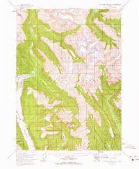
1955 Map of Bradfield canal B-6
USGS Topo · Published 1965About this map
Tongass National Forest dominates this mid-century survey of the Alaskan coastline near Wrangell. The map documents the immense ice and water systems of the region, featuring Nelson Glacier in the northwest and the tidal drainage of Aaron Creek. Along the southwestern edge, the eastern shore of Wrangell Island is visible across Blake Channel, marked by prominent coastal features like Capel Pt.
Find a feature on this map
18 named features on this map. Tap any name to fly to it.
Don’t see what you’re looking for? This feature index may not catch every label — zoom into the map to look around manually.
Map Details
Editions of this 1955 Bradfield canal B-6 Map
3 editions found

Other maps of this area

1948 · Petersburg A-1
USGS Topo · 1:63,360

1948 · Petersburg C-1
USGS Topo · 1:63,360

1948 · Petersburg B-1
USGS Topo · 1:63,360

1951 · Bradfield Canal
USGS Topo · 1:250,000

1951 · Petersburg A-1
USGS Topo · 1:63,360

1952 · Petersburg
USGS Topo · 1:250,000

1953 · Petersburg C-1
USGS Topo · 1:63,360

1954 · Bradfield Canal
USGS Topo · 1:250,000

1955 · Bradfield canal A-6
USGS Topo · 1:63,360

1955 · Bradfield canal B-5
USGS Topo · 1:63,360