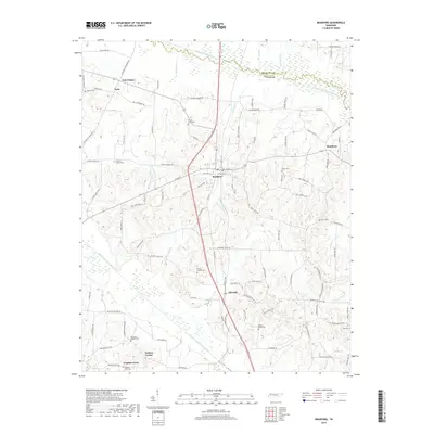
2019 Map of Bradford
USGS Topo · Published 2019About this map
The South Fork Obion River and Rutherford Fork Obion River define the northern and southern drainage of this Gibson County landscape. Centered on the town of Bradford, the map illustrates a network of rural settlements including Idlewild, Skullbone, and Lynn. The area's genealogical record is well-represented through numerous community burial grounds such as Locust Grove Cem, Shiloh Cem, and Mount Pisgah Cem, often situated near rural junctions like Four Points and Tuckers Corner. The road system follows the local topography, with routes like Old Trenton Dresden Rd and Griffin Chapel Rd connecting long-established family homesteads and farms. Smaller waterways, including Bear Cr and Dolan Cr, cut through the terrain, creating a pattern of creekside agriculture and scattered dwellings that have persisted into the modern era.
Find a feature on this map
105 named features on this map. Tap any name to fly to it.
Don’t see what you’re looking for? This feature index may not catch every label — zoom into the map to look around manually.
Map Details
Editions of this 2019 Bradford Map
This is the sole edition of this map. No revisions or reprints were ever made.
Other maps of this area

1951 · Trenton
USGS Topo · 1:24,000

1952 · Milan
USGS Topo · 1:24,000

1953 · Dyer
USGS Topo · 1:24,000

1954 · Rutherford
USGS Topo · 1:24,000

1954 · Greenfield
USGS Topo · 1:24,000

1954 · Bradford
USGS Topo · 1:24,000

1956 · Dyersburg
USGS Topo · 1:250,000

1956 · Blytheville
USGS Topo · 1:250,000

1959 · Blytheville
USGS Topo · 1:250,000

1966 · Atwood
USGS Topo · 1:24,000