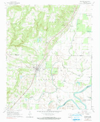
1968 Map of Bradford
USGS Topo · Published 1991About this map
The Missouri Pacific railroad corridor serves as the central artery for this portion of White and Jackson Counties, dictating the alignment of the region's early settlements. Along this rail line, the town of Bradford sits as a primary hub, while the uniquely named Possum Grape and nearby Grand Glaise mark smaller social centers to the north. The landscape is a distinct mix of upland terrain to the west and a complex lowland river system to the east.
Find a feature on this map
49 named features on this map. Tap any name to fly to it.
Don’t see what you’re looking for? This feature index may not catch every label — zoom into the map to look around manually.
Map Details
Editions of this 1968 Bradford Map
2 editions found
Other maps of this area

1890 · Batesville
USGS Topo · 1:125,000

1891 · Batesville
USGS Topo · 1:125,000

1935 · Newport
USGS Topo · 1:62,500

1935 · Augusta
USGS Topo · 1:62,500

1935 · Bald Knob
USGS Topo · 1:62,500

1953 · Memphis
USGS Topo · 1:250,000

1956 · Memphis
USGS Topo · 1:250,000

1957 · Augusta
USGS Topo · 1:62,500
1962 · Olyphant
USGS Topo · 1:24,000

1962 · Newport
USGS Topo · 1:24,000