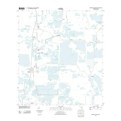
2012 Map of Bradley Junction
USGS Topo · Published 2012About this map
The N Prong Alafia River and S Prong Alafia River carve through a landscape heavily defined by industrial extraction in this western Polk County corridor. While the area is dotted with small residential nodes like Rolling Hills and Oak Terrace, the map's geography is dominated by large-scale mining operations and water management features. The grid of service roads, including Hooker Prairie Mine Rd and Bonnie Mine Rd, suggests the deep footprint of the phosphate industry that has long shaped this region's economy and topography.
Find a feature on this map
45 named features on this map. Tap any name to fly to it.
Don’t see what you’re looking for? This feature index may not catch every label — zoom into the map to look around manually.
Map Details
Editions of this 2012 Bradley Junction Map
This is the sole edition of this map. No revisions or reprints were ever made.
Other maps of this area

1949 · Mulberry
USGS Topo · 1:24,000

1949 · Bartow
USGS Topo · 1:24,000

1949 · Bradley Junction
USGS Topo · 1:24,000

1950 · Mulberry
USGS Topo · 1:24,000

1950 · Bartow
USGS Topo · 1:24,000

1950 · Bradley Junction
USGS Topo · 1:24,000

1952 · Homeland
USGS Topo · 1:24,000

1955 · Bowling Green
USGS Topo · 1:24,000

1955 · Nichols
USGS Topo · 1:24,000

1955 · Baird
USGS Topo · 1:24,000