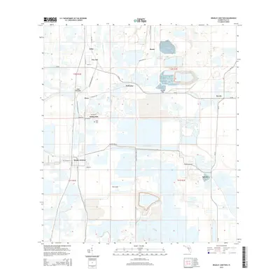
2015 Map of Bradley Junction
USGS Topo · Published 2015About this map
Bradley Junction and the surrounding industrial landscape of Polk County are defined by a network of specialized transport routes and water systems in this 2015 study. The terrain is heavily modified by large-scale mining operations, indicated by features like Agricola Mine Rd and Hooker's Prairie Mine Rd, which connect various settlement nodes such as Agricola, Pebbledale, and Pierce. The movement of resources is central to the area's layout, with CR-640 and CR-555 acting as primary arteries alongside several rail corridors.
Find a feature on this map
35 named features on this map. Tap any name to fly to it.
Don’t see what you’re looking for? This feature index may not catch every label — zoom into the map to look around manually.
Map Details
Editions of this 2015 Bradley Junction Map
This is the sole edition of this map. No revisions or reprints were ever made.
Other maps of this area

1949 · Mulberry
USGS Topo · 1:24,000

1949 · Bartow
USGS Topo · 1:24,000

1949 · Bradley Junction
USGS Topo · 1:24,000

1950 · Mulberry
USGS Topo · 1:24,000

1950 · Bartow
USGS Topo · 1:24,000

1950 · Bradley Junction
USGS Topo · 1:24,000

1952 · Homeland
USGS Topo · 1:24,000

1955 · Bowling Green
USGS Topo · 1:24,000

1955 · Nichols
USGS Topo · 1:24,000

1955 · Baird
USGS Topo · 1:24,000