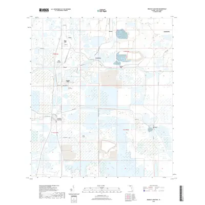
2018 Map of Bradley Junction
USGS Topo · Published 2018About this map
The phosphate-rich landscape of Polk County is clearly visible on this 2018 survey, centered on the historic crossroads of Bradley Junction. This area, deeply tied to Florida's mining history, features a cluster of company-founded settlements and small residential communities including Pebbledale, Pierce, and Agricola. The industrial footprint is evident in the specialized road network, with names like Bonnie Mine Rd and Hooker Prairie Mine Rd leading toward expansive excavation sites and settling ponds.
Find a feature on this map
42 named features on this map. Tap any name to fly to it.
Don’t see what you’re looking for? This feature index may not catch every label — zoom into the map to look around manually.
Map Details
Editions of this 2018 Bradley Junction Map
This is the sole edition of this map. No revisions or reprints were ever made.
Other maps of this area

1949 · Mulberry
USGS Topo · 1:24,000

1949 · Bartow
USGS Topo · 1:24,000

1949 · Bradley Junction
USGS Topo · 1:24,000

1950 · Mulberry
USGS Topo · 1:24,000

1950 · Bartow
USGS Topo · 1:24,000

1950 · Bradley Junction
USGS Topo · 1:24,000

1952 · Homeland
USGS Topo · 1:24,000

1955 · Bowling Green
USGS Topo · 1:24,000

1955 · Nichols
USGS Topo · 1:24,000

1955 · Baird
USGS Topo · 1:24,000