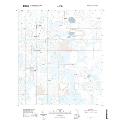
2021 Map of Bradley Junction
USGS Topo · Published 2021About this map
Bradley Junction and Agricola sit at the heart of a landscape defined by Florida's phosphate mining history and hydrology. The terrain is a complex network of wetlands and man-made alterations, notably surrounding Pebbledale and Green Bay. The drainage of the N Prong Alafia River and S Prong Alafia River shapes the southern and western reaches, while the expansive Hookers Prairie occupies the southeastern corner. Small settlements and residential clusters such as Oak Terrace, Pine Dale, and Achan are connected by a grid of industrial and rural roads like Bonnie Mine Rd and Agricola Rd. For the local historian, the presence of the Mount Olive Cem near Rolling Hills provides a fixed genealogical reference point amidst a landscape otherwise heavily modified by modern extractive industry.
Find a feature on this map
43 named features on this map. Tap any name to fly to it.
Don’t see what you’re looking for? This feature index may not catch every label — zoom into the map to look around manually.
Map Details
Editions of this 2021 Bradley Junction Map
This is the sole edition of this map. No revisions or reprints were ever made.
Other maps of this area

1949 · Mulberry
USGS Topo · 1:24,000

1949 · Bartow
USGS Topo · 1:24,000

1949 · Bradley Junction
USGS Topo · 1:24,000

1950 · Mulberry
USGS Topo · 1:24,000

1950 · Bartow
USGS Topo · 1:24,000

1950 · Bradley Junction
USGS Topo · 1:24,000

1952 · Homeland
USGS Topo · 1:24,000

1955 · Bowling Green
USGS Topo · 1:24,000

1955 · Nichols
USGS Topo · 1:24,000

1955 · Baird
USGS Topo · 1:24,000