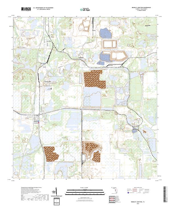
2024 Map of Bradley Junction
USGS Topo · Published 2024About this map
Bradley Junction serves as a focal point in this portion of Polk County, where industrial land use and small residential pockets meet. The landscape is heavily shaped by the region's phosphate mining history, evidenced by the large rectangular impoundments and modified terrain surrounding Pebbledale, Bonnie, and Agricola. These industrial footprints contrast with the natural drainage of the South Prong Alafia River and the low-lying expanse of Hookers Prairie to the southeast.
Find a feature on this map
36 named features on this map. Tap any name to fly to it.
Don’t see what you’re looking for? This feature index may not catch every label — zoom into the map to look around manually.
Map Details
Editions of this 2024 Bradley Junction Map
This is the sole edition of this map. No revisions or reprints were ever made.
Other maps of this area

1949 · Mulberry
USGS Topo · 1:24,000

1949 · Bartow
USGS Topo · 1:24,000

1949 · Bradley Junction
USGS Topo · 1:24,000

1950 · Mulberry
USGS Topo · 1:24,000

1950 · Bartow
USGS Topo · 1:24,000

1950 · Bradley Junction
USGS Topo · 1:24,000

1952 · Homeland
USGS Topo · 1:24,000

1955 · Bowling Green
USGS Topo · 1:24,000

1955 · Nichols
USGS Topo · 1:24,000

1955 · Baird
USGS Topo · 1:24,000