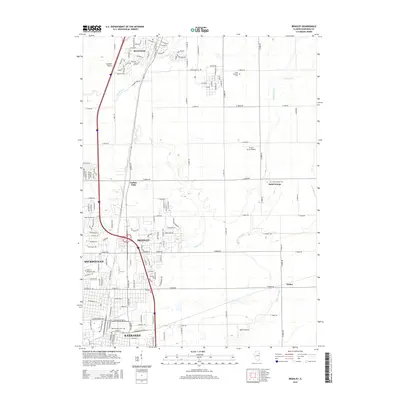
2015 Map of Bradley
USGS Topo · Published 2015About this map
Kankakee and Bradley anchor the southern portion of this landscape, showing the dense residential grid and industrial expansion of these Illinois communities in the mid-2010s. Northward, the map transitions into the suburban and rural fringes of Manteno, where newer developments like McGuire Dr and E Amberstone Rd meet traditional farmland. The area is defined by a series of small airfields, including Spangler Airport and Benoit Airport, alongside significant institutional grounds such as Olivet Nazarene Univ. Drainage patterns are clearly marked by Exline Slough and Soldier Cr, which navigate the flat prairie terrain between scattered settlements like Indian Oaks and Saint George. For local historians, the inclusion of the State Hospital Cem and Mound Grove Cem provides specific points for genealogical research within the larger urban-to-rural transition of Kankakee County.
Find a feature on this map
150 named features on this map. Tap any name to fly to it.
Don’t see what you’re looking for? This feature index may not catch every label — zoom into the map to look around manually.
Map Details
Editions of this 2015 Bradley Map
This is the sole edition of this map. No revisions or reprints were ever made.
Other maps of this area

1922 · Momence
USGS Topo · 1:62,500

1922 · Kankakee
USGS Topo · 1:62,500

1924 · Momence
USGS Topo · 1:62,500

1924 · Kankakee
USGS Topo · 1:62,500

1949 · Peotone
USGS Topo · 1:62,500

1949 · Crete
USGS Topo · 1:62,500

1953 · Beecher West
USGS Topo · 1:24,000

1953 · Peotone
USGS Topo · 1:24,000

1953 · Wilton Center
USGS Topo · 1:24,000

1953 · Chicago
USGS Topo · 1:250,000