
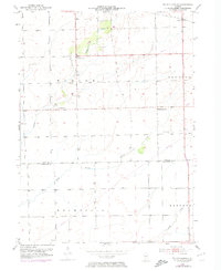
1953 Map of Wilton Center
USGS Topo · Published 1955About this map
The agrarian landscape of southern Will County and northern Kankakee County is defined by the winding course of Forked Creek and its South Branch. The small community of Wilton Center serves as a focal point, surrounded by historic markers of settlement including the Wilton Cem and Calvary Cem. To the northeast, the settlement of Andres sits along the tracks of the C M St P & P railroad, illustrating the importance of rail transit for this farming region in the early 1950s. The survey also captures rural spiritual life through localized landmarks such as St Patricks Ch and the West Peotone Ch, alongside the West Peotone Cem. Wooded pockets like Gerdes Woods punctuate the open fields, providing a detailed look at the land use across Wilton, Peotone, and Rockville townships.
Find a feature on this map
16 named features on this map. Tap any name to fly to it.
Don’t see what you’re looking for? This feature index may not catch every label — zoom into the map to look around manually.
Map Details
Editions of this 1953 Wilton Center Map
2 editions found
Other maps of this area

1892 · Wilmington
USGS Topo · 1:62,500

1918 · Wilmington
USGS Topo · 1:62,500

1922 · Kankakee
USGS Topo · 1:62,500

1923 · Herscher
USGS Topo · 1:62,500

1924 · Kankakee
USGS Topo · 1:62,500

1925 · Herscher
USGS Topo · 1:62,500

1929 · Brisbane
USGS Topo · 1:24,000

1930 · Frankfort
USGS Topo · 1:24,000

1949 · Peotone
USGS Topo · 1:62,500

1953 · Peotone
USGS Topo · 1:24,000