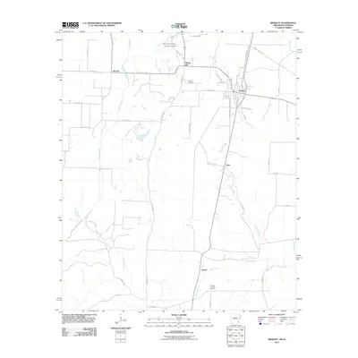
2011 Map of Bradley
USGS Topo · Published 2011About this map
Bradley serves as the primary hub on this Lafayette County landscape, where the town's grid of streets like Elm Ave and Pilot Ave transitions into a network of drainage ditches and rural roads. The area's agricultural and industrial character is evident through the naming of small settlements such as Gin City and the presence of the Arkana Oil and Gas Field in the southern reaches. Local history is anchored by several burial grounds, including the Walnut Hill Cemetery and Saint Mary Cemetery located near the community of Walnut Hill. The terrain is defined by a slow-moving hydrological system where Posten Bayou and Wheeler Creek wind through the flatlands, reflecting the region's position near the Arkansas-Louisiana border. Tracing the path of Lafayette 233 and County Rd 286 reveals a landscape dedicated to timber, cotton, and energy production.
Find a feature on this map
47 named features on this map. Tap any name to fly to it.
Don’t see what you’re looking for? This feature index may not catch every label — zoom into the map to look around manually.
Map Details
Editions of this 2011 Bradley Map
This is the sole edition of this map. No revisions or reprints were ever made.
Other maps of this area

1932 · Hosston NE
USGS Topo · 1:31,680

1948 · Vivian
USGS Topo · 1:62,500

1950 · Plain Dealing NE
USGS Topo · 1:31,680

1950 · Plain Dealing NW
USGS Topo · 1:31,680

1952 · Doddridge SE
USGS Topo · 1:24,000

1952 · Bradley
USGS Topo · 1:24,000

1952 · Bradley NE
USGS Topo · 1:24,000

1952 · Doddridge NE
USGS Topo · 1:24,000

1952 · Canfield
USGS Topo · 1:24,000

1952 · Bradley SE
USGS Topo · 1:24,000