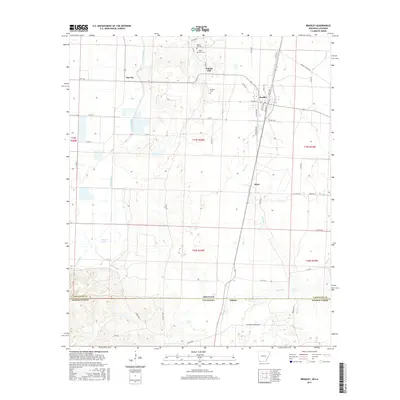
2017 Map of Bradley
USGS Topo · Published 2017About this map
Bradley serves as the central hub of this agricultural landscape in Lafayette County, where the terrain is defined by a network of slow-moving waters and small settlements. The town of Gin City and the historic crossroads of Walnut Hill sit north of the main settlement, with the latter featuring the Walnut Hill Cemetery and Saint Mary Cemetery. The border between Arkansas and Louisiana cuts across the southern portion of the map, marked by the small community of Arkana. The physical geography is dominated by Posten Bayou and its drainage through Enyart Lake, while the eastern side of the quadrangle is drained by Wheeler Creek and Martin Creek. This 2017 survey reflects a deeply rural region where local life is organized around established township lines and long-standing family-named cemeteries, such as the Bradley Cemetery, situated near the heart of the community.
Find a feature on this map
63 named features on this map. Tap any name to fly to it.
Don’t see what you’re looking for? This feature index may not catch every label — zoom into the map to look around manually.
Map Details
Editions of this 2017 Bradley Map
This is the sole edition of this map. No revisions or reprints were ever made.
Other maps of this area

1932 · Hosston NE
USGS Topo · 1:31,680

1948 · Vivian
USGS Topo · 1:62,500

1950 · Plain Dealing NE
USGS Topo · 1:31,680

1950 · Plain Dealing NW
USGS Topo · 1:31,680

1952 · Doddridge SE
USGS Topo · 1:24,000

1952 · Bradley
USGS Topo · 1:24,000

1952 · Bradley NE
USGS Topo · 1:24,000

1952 · Doddridge NE
USGS Topo · 1:24,000

1952 · Canfield
USGS Topo · 1:24,000

1952 · Bradley SE
USGS Topo · 1:24,000