
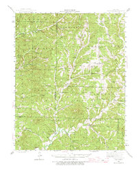
1943 Map of Bradleyville
USGS Topo · Published 1968About this map
Bradleyville and the winding course of Beaver Creek anchor this mid-century portrait of the Missouri Ozarks. Situated at the convergence of Christian, Taney, and Douglas counties, the landscape is defined by a dense network of hollows and ridges like Marshfield Ridge and Turnip Knob. The mapping reveals a highly localized social geography of the 1940s, where small settlements such as Brownbranch, Rome, and McClurg were supported by numerous rural schoolhouses, including Whiteside Sch and Goodhope Sch.
Find a feature on this map
85 named features on this map. Tap any name to fly to it.
Don’t see what you’re looking for? This feature index may not catch every label — zoom into the map to look around manually.
Map Details
Editions of this 1943 Bradleyville Map
2 editions found
Other maps of this area

1884 · Springfield
USGS Topo · 1:125,000

1886 · Springfield
USGS Topo · 1:125,000

1907 · Forsyth
USGS Topo · 1:125,000

1936 · Thornfield
USGS Topo · 1:48,000

1936 · Ava
USGS Topo · 1:48,000

1937 · Bradleyville
USGS Topo · 1:48,000

1937 · Ozark
USGS Topo · 1:48,000

1939 · Fordland
USGS Topo · 1:62,500

1942 · Fordland
USGS Topo · 1:62,500

1942 · Ava
USGS Topo · 1:62,500