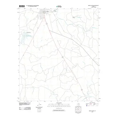
2010 Map of Brady South
USGS Topo · Published 2010About this map
Brady anchors the northern edge of this landscape, where the town street grid transitions into the sprawling ranchland of McCulloch County. The area is defined by its water management systems, including the Soil Conservation Service Site 1 Dam and the Shropshire Lake Dam, reflecting the mid-century push for flood control and water storage in the Texas Hill Country. To the south, the terrain descends toward the San Saba River, which cuts across the bottom corner of the map. Between the town and the river lies a network of drainage features like Staten Creek and Flat Branch, alongside numerous county roads that provide access to the rural homesteads and agricultural plots that have sustained this region for generations.
Find a feature on this map
20 named features on this map. Tap any name to fly to it.
Don’t see what you’re looking for? This feature index may not catch every label — zoom into the map to look around manually.
Map Details
Editions of this 2010 Brady South Map
This is the sole edition of this map. No revisions or reprints were ever made.
Other maps of this area

1887 · Mason
USGS Topo · 1:125,000

1894 · Brady
USGS Topo · 1:125,000

1894 · Mason
USGS Topo · 1:125,000

1954 · Brownwood
USGS Topo · 1:250,000

1954 · Llano
USGS Topo · 1:250,000

1955 · Llano
USGS Topo · 1:250,000

1956 · Llano
USGS Topo · 1:250,000

1960 · West Sweden
USGS Topo · 1:24,000

1960 · Brady North
USGS Topo · 1:24,000

1963 · Spy Rock
USGS Topo · 1:24,000