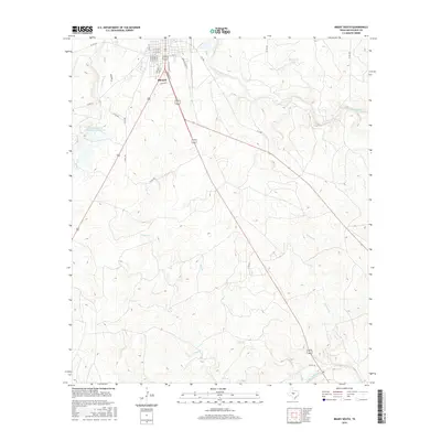
2016 Map of Brady South
USGS Topo · Published 2016About this map
The southern outskirts of Brady mark the transition into the ranching and livestock country of McCulloch County, where the landscape is defined by the drainage network of the San Saba River and its numerous tributaries. Settled within this terrain is the community of Lynn Gavit, positioned just south of the main township. The map details a sophisticated water management system, including the Soil Conservation Service Site 1 Reservoir and Shropshire Lake, which support the region's agricultural needs. Several seasonal watercourses, such as Staten Creek, Flat Branch, and Hudson Branch, carve through the land, illustrating the complex hydrology that governs this part of Central Texas. This 2016 survey traces the modern road network, from major routes like S Bridge St to remote county roads like Co Rd 100, documenting how human development integrates with the natural draws and creek beds.
Find a feature on this map
34 named features on this map. Tap any name to fly to it.
Don’t see what you’re looking for? This feature index may not catch every label — zoom into the map to look around manually.
Map Details
Editions of this 2016 Brady South Map
This is the sole edition of this map. No revisions or reprints were ever made.
Other maps of this area

1887 · Mason
USGS Topo · 1:125,000

1894 · Brady
USGS Topo · 1:125,000

1894 · Mason
USGS Topo · 1:125,000

1954 · Brownwood
USGS Topo · 1:250,000

1954 · Llano
USGS Topo · 1:250,000

1955 · Llano
USGS Topo · 1:250,000

1956 · Llano
USGS Topo · 1:250,000

1960 · West Sweden
USGS Topo · 1:24,000

1960 · Brady North
USGS Topo · 1:24,000

1963 · Spy Rock
USGS Topo · 1:24,000