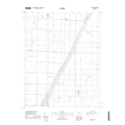
2017 Map of Bragg City
USGS Topo · Published 2017About this map
Bragg City and its surrounding agricultural landscape dominate this survey of the Missouri Bootheel, where the heavy hand of 20th-century water management is on full display. The terrain is defined by a complex grid of engineered waterways, including Ditch Number 293, Ditch Number 85, and Ditch Number 1, which drain the low-lying basin into the channelized Little River. Small settlements such as Peach Orchard, Sumach, and Kirk are scattered along the section lines and highway junctions, illustrating the rural residential patterns of Pemiscot and Dunklin counties. Near the town center of Bragg City, Clay Root Bayou and Big Bayou remain as natural drainage features amidst the straight-line drainage canals. Genealogists will find the Sumach Cem located near the intersection of State Highway 153 and Highway HH, a localized landmark in a region where the Old Channel Little River still traces its original meandering path despite modern hydrological changes.
Find a feature on this map
63 named features on this map. Tap any name to fly to it.
Don’t see what you’re looking for? This feature index may not catch every label — zoom into the map to look around manually.
Map Details
Editions of this 2017 Bragg City Map
This is the sole edition of this map. No revisions or reprints were ever made.
Other maps of this area

1934 · Kennett
USGS Topo · 1:62,500

1940 · Pascola
USGS Topo · 1:62,500

1940 · Kennett
USGS Topo · 1:62,500

1940 · Hayti
USGS Topo · 1:62,500

1940 · Piggott
USGS Topo · 1:62,500

1955 · Pascola
USGS Topo · 1:62,500

1955 · Hayti
USGS Topo · 1:62,500

1956 · Kennett
USGS Topo · 1:62,500

1956 · Piggott
USGS Topo · 1:62,500

1956 · Dyersburg
USGS Topo · 1:250,000