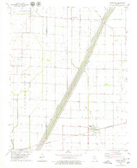
1978 Map of Bragg City
USGS Topo · Published 1979About this map
The lowlands of Dunklin and Pemiscot Counties are defined by a sophisticated system of engineered drainage, with The Little River Floodway serving as the central artery. This late 1970s landscape shows a highly regulated water network where Little River Old Channel and Big Bayou exist alongside an extensive grid of numbered ditches, such as Ditch No 1 and Ditch No 85. The settlement pattern is anchored by Bragg City in the southeast and Peach Orchard to the north, connected by the St Louis-San Francisco railroad line. Rural life during this era centered on small community landmarks like Tatum Chapel, Sumach Ch, and Ford Chapel, while the presence of an Old Grade Railroad suggests the evolving transportation needs of the Missouri Bootheel’s agricultural economy.
Find a feature on this map
33 named features on this map. Tap any name to fly to it.
Don’t see what you’re looking for? This feature index may not catch every label — zoom into the map to look around manually.
Map Details
Editions of this 1978 Bragg City Map
This is the sole edition of this map. No revisions or reprints were ever made.
Other maps of this area

1934 · Kennett
USGS Topo · 1:62,500

1940 · Pascola
USGS Topo · 1:62,500

1940 · Kennett
USGS Topo · 1:62,500

1940 · Hayti
USGS Topo · 1:62,500

1940 · Piggott
USGS Topo · 1:62,500

1955 · Pascola
USGS Topo · 1:62,500

1955 · Hayti
USGS Topo · 1:62,500

1956 · Kennett
USGS Topo · 1:62,500

1956 · Piggott
USGS Topo · 1:62,500

1956 · Dyersburg
USGS Topo · 1:250,000