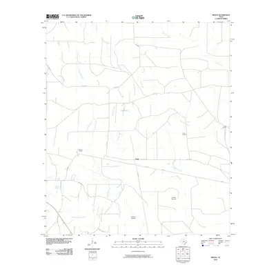
2010 Map of Bragg
USGS Topo · Published 2010About this map
Bragg occupies the center of this Hardin County landscape, where the local economy and geography are defined by a complex network of waterways and timber-related sites. The presence of Thicket Siding indicates the enduring role of rail transport in moving resources through this corner of the Big Thicket region. The map reveals intriguing local nomenclature with features such as Dunnie Burnout and Old Hat Burnout, which likely reflect the history of forestry or land management in the area.
Find a feature on this map
23 named features on this map. Tap any name to fly to it.
Don’t see what you’re looking for? This feature index may not catch every label — zoom into the map to look around manually.
Map Details
Editions of this 2010 Bragg Map
This is the sole edition of this map. No revisions or reprints were ever made.
Other maps of this area

1943 · Liberty
USGS Topo · 1:125,000

1954 · Beaumont
USGS Topo · 1:250,000

1955 · Saratoga
USGS Topo · 1:62,500

1955 · Kountze
USGS Topo · 1:62,500

1957 · Beaumont
USGS Topo · 1:250,000

1958 · Segno
USGS Topo · 1:62,500

1958 · Warren
USGS Topo · 1:62,500

1984 · Segno
USGS Topo · 1:24,000

1984 · Beaumont
USGS Topo · 1:250,000

1984 · Jacks Creek South
USGS Topo · 1:24,000