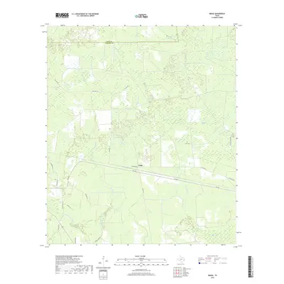
2019 Map of Bragg
USGS Topo · Published 2019About this map
Bragg occupies the center of this landscape in the Big Thicket region, where the Polk and Hardin county lines meet amidst a complex network of wetlands. The area is defined by its sluggish watercourses, including the wide reaches of Jayhawker Bayou and the meandering Little Pine Island Bayou. Transportation through these bottomlands is centered on FM 1293 and several roads named for local landmarks, such as Old Bragg Rd and Sutton Cemetery Rd. For genealogists and local historians, the presence of Sutton Cem and Griffin Cem provides specific points of interest within the dense pine and hardwood forests. The drainage patterns of Flat Cypress Cr, Bad Luck Cr, and Union Well Cr suggest the low-lying, swampy character of the terrain that historically challenged settlement and travel in this part of East Texas.
Find a feature on this map
28 named features on this map. Tap any name to fly to it.
Don’t see what you’re looking for? This feature index may not catch every label — zoom into the map to look around manually.
Map Details
Editions of this 2019 Bragg Map
This is the sole edition of this map. No revisions or reprints were ever made.
Other maps of this area

1943 · Liberty
USGS Topo · 1:125,000

1954 · Beaumont
USGS Topo · 1:250,000

1955 · Saratoga
USGS Topo · 1:62,500

1955 · Kountze
USGS Topo · 1:62,500

1957 · Beaumont
USGS Topo · 1:250,000

1958 · Segno
USGS Topo · 1:62,500

1958 · Warren
USGS Topo · 1:62,500

1984 · Segno
USGS Topo · 1:24,000

1984 · Beaumont
USGS Topo · 1:250,000

1984 · Jacks Creek South
USGS Topo · 1:24,000