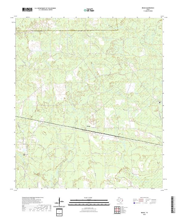
2022 Map of Bragg
USGS Topo · Published 2022About this map
Bragg occupies the center of this landscape where the Polk and Hardin County line forms the northern limit of a complex wetland network. The drainage patterns of the Big Thicket region are evident here, defined by the slow-moving Little Pine Island Bayou and the unusually named Jayhawker Baggall. The settlement pattern is sparse, tied to early road clearings like Old Bragg Rd and Segno Rd, with several family burial grounds scattered across the terrain. These sites, including Griffin Cem and Sutton Cem, suggest a history of isolated homesteads and timber-related work in an area dominated by numerous seasonal water bodies like Doe Ponds and winding creeks such as Bad Luck Cr and Flat Cypress Cr. The road network, featuring FM 1293 and FM 787, provides the primary modern framework for navigating this heavily forested and water-logged environment.
Find a feature on this map
30 named features on this map. Tap any name to fly to it.
Don’t see what you’re looking for? This feature index may not catch every label — zoom into the map to look around manually.
Map Details
Editions of this 2022 Bragg Map
This is the sole edition of this map. No revisions or reprints were ever made.
Other maps of this area

1943 · Liberty
USGS Topo · 1:125,000

1954 · Beaumont
USGS Topo · 1:250,000

1955 · Saratoga
USGS Topo · 1:62,500

1955 · Kountze
USGS Topo · 1:62,500

1957 · Beaumont
USGS Topo · 1:250,000

1958 · Segno
USGS Topo · 1:62,500

1958 · Warren
USGS Topo · 1:62,500

1984 · Segno
USGS Topo · 1:24,000

1984 · Beaumont
USGS Topo · 1:250,000

1984 · Jacks Creek South
USGS Topo · 1:24,000