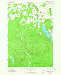
1964 Map of Brainardsville
USGS Topo · Published 1966About this map
Brainardsville serves as the primary hub in this mid-1960s landscape, where the Chateaugay River flows north toward the Canadian border. The settlement pattern is defined by the valley's water resources, notably at The Forge and the small upland clearing of Blairs Kiln. To the south, the terrain rises sharply into the Adirondack State Park, a densely wooded region marked by isolated water bodies like Figure Eight Pond and Lilypad Pond near Figure Eight Mountain. Genealogy researchers will find several family and community burial grounds, including Bigelow Cem, Merrill Cem, and Bunker Hill Cem, which dot the rural roadsides. The transition from the developed northern townships of Burke and Ellenburg to the State Forest Preserve illustrates the edge of the wilderness, where the Lower Chateaugay Lake narrows into the Chateaugay Narrows.
Find a feature on this map
52 named features on this map. Tap any name to fly to it.
Don’t see what you’re looking for? This feature index may not catch every label — zoom into the map to look around manually.
Map Details
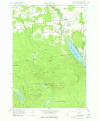
Editions of this 1964 Brainardsville Map
2 editions found
Other maps of this area

1906 · Loon Lake
USGS Topo · 1:62,500

1908 · Loon Lake
USGS Topo · 1:62,500

1911 · Lyon Mountain
USGS Topo · 1:62,500

1913 · Lyon Mountain
USGS Topo · 1:62,500

1915 · Churubusco
USGS Topo · 1:62,500

1915 · Chateaugay
USGS Topo · 1:62,500

1931 · Lyon Mountain
USGS Topo · 1:62,500

1943 · Churubusco
USGS Topo · 1:62,500

1943 · Chateaugay
USGS Topo · 1:62,500

1948 · Ogdensburg
USGS Topo · 1:250,000