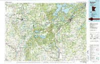
1986 Map of Brainerd
USGS Topo · Published 1991About this map
The Mississippi River winds through the heart of this central Minnesota landscape, where the confluence of the Crow Wing River marks a historic transition point for river travel and timber transport. In the 1980s, this region was defined by a complex mosaic of conservation lands, including the Pillsbury State Forest and numerous specialized wildlife zones like the Turtle Creek State Wildlife Management Area. The city of Brainerd and neighboring Baxter serve as the primary hubs, surrounded by a dense network of lakes such as Gull Lake and Pelican Lake that highlight the area's transition into the northern vacation country.
Find a feature on this map
157 named features on this map. Tap any name to fly to it.
Don’t see what you’re looking for? This feature index may not catch every label — zoom into the map to look around manually.
Map Details
Editions of this 1986 Brainerd Map
2 editions found
Other maps of this area

1912 · Deerwood
USGS Topo · 1:62,500

1913 · Cuyuna
USGS Topo · 1:62,500

1914 · Deerwood
USGS Topo · 1:62,500

1915 · Cuyuna
USGS Topo · 1:62,500

1915 · Brainerd
USGS Topo · 1:62,500

1916 · Pillager
USGS Topo · 1:62,500

1918 · Brainerd
USGS Topo · 1:62,500

1919 · Pillager
USGS Topo · 1:62,500

1919 · Leader
USGS Topo · 1:62,500

1947 · Flensburg
USGS Topo · 1:25,000