
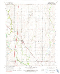
1967 Map of Braman
USGS Topo · Published 1970About this map
Braman serves as the central hub of this northern Oklahoma landscape, where the agricultural plains meet the industrial footprint of the Braman Oil Field and the North Braman Oil Field. The town is positioned along the Atchison Topeka and Santa Fe railroad, while the modern era is marked by the construction of the 4 Lane highway and the Braman Interchange. In the southern portion of the sheet, the village of Sumpter sits near an Old Railroad Grade, showing how transport networks shifted over time.
Find a feature on this map
24 named features on this map. Tap any name to fly to it.
Don’t see what you’re looking for? This feature index may not catch every label — zoom into the map to look around manually.
Map Details
Editions of this 1967 Braman Map
2 editions found
Other maps of this area

1890 · Wellington
USGS Topo · 1:125,000

1955 · Wichita
USGS Topo · 1:250,000

1955 · Enid
USGS Topo · 1:250,000

1958 · Enid
USGS Topo · 1:250,000

1958 · Wichita
USGS Topo · 1:250,000

1965 · Portland
USGS Topo · 1:24,000

1965 · South Haven
USGS Topo · 1:24,000

1965 · Geuda Springs
USGS Topo · 1:24,000

1968 · Blackwell NW
USGS Topo · 1:24,000

1968 · Nardin
USGS Topo · 1:24,000